Scan to Download
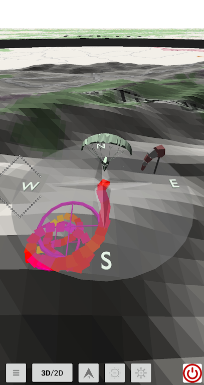
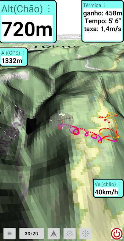
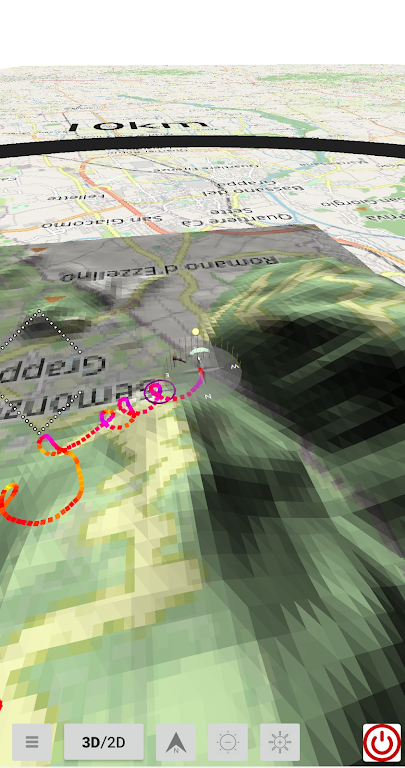
Supersense 3D Free Flight is an innovative app designed to revolutionize the way pilots map thermals during flight. With its advanced features, this app allows pilots to easily track their flight trail in 3D, providing a comprehensive visualization of thermals. Using an existing igc file, pilots can test the application and replay their flight, gaining valuable insights and improving their skills. The app also offers a user-friendly interface, displaying flight information through customizable infoboxes. Pilots can effortlessly drag and position the infoboxes on their screen, choosing the font size for crucial data like GPS altitude, altitude above ground level, and speed over ground. Additionally, the app allows users to download elevation data from various continents, providing accurate and detailed information. To optimize the app's functionality, we recommend trying it with a .igc file, adjusting the infoboxes' position and font size during replay for an optimized experience.
❤ Free Flight Software: Supersense 3D offers free flight software, allowing pilots to explore and navigate their flights without any additional cost. This makes it an attractive option for pilots looking for budget-friendly solutions.
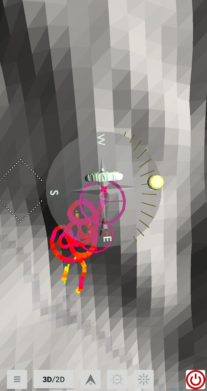
❤ Thermals Mapping: The app supports pilots in mapping thermals through its 3D flight trail feature. This enables pilots to analyze and identify thermal patterns during their flights, enhancing their overall flying experience.
❤ Intuitive Interface: Supersense 3D provides an intuitive interface that displays flight information through infoboxes. Pilots can easily customize the location of these infoboxes by dragging them with their finger. Additionally, the app allows users to adjust the text font size, making it easier to read critical information such as GPS altitude, altitude above ground level, and speed over ground.
❤ Elevation Data Download: Users have the option to download elevation data from each continent using Supersense 3D. This data is sourced from the freely available NASA project, specifically the SRTM project. By downloading this data, pilots can access accurate terrain information and make more informed flight decisions.
❤ How do I use Supersense 3D for the first time?
We recommend that you try replaying a .igc file to familiarize yourself with the app's features. During the replay, you can drag the infoboxes to your desired location and adjust the text size by double-clicking the infobox. A menu will appear, allowing you to choose the font size.
❤ Can I customize the appearance of the infoboxes?
Yes, Supersense 3D allows you to drag the infoboxes to your preferred location on the screen. This customization feature ensures that the infoboxes display important flight information exactly where you want them during your flight.
❤ What does the elevation data download offer?
The app allows you to download elevation data from each continent. This data is obtained from the SRTM project by NASA and provides accurate terrain information for improved flight planning and decision-making.
With its ability to map thermals, display flight information intuitively, and provide elevation data downloads, this app enhances the flying experience for pilots of all levels. Whether you're a seasoned pilot or just starting out, Supersense 3D Free Flight is a valuable tool for optimizing your flights and making more informed decisions in the skies. Download Supersense 3D today and take your flying experience to new heights.
File size: 11.30 M Latest Version: 451.0
Requirements: Android Language: English
Votes: 327 Package ID: com.openglsupersense
Developer: MARIO DE QUEIROZ MONTEIRO

Explore the world with confidence using our intuitive map software. Navigate unfamiliar cities, find hidden gems, and plan adventures with ease. Our powerful apps feature robust offline functionality, real-time traffic updates, and crowd-sourced points of interest. Customize maps to match your needs - save favorite locations, download areas for offline access, and share recommendations.


LIVE A HERO
Retro Hero Mr Kim
Empire of Passion
Arcane Quest Legends
Magic Snap: Momotaro
AllStar Manga Heroes
Lunescape
ONE PIECE Thousand Storm JP
Tap Titans 2