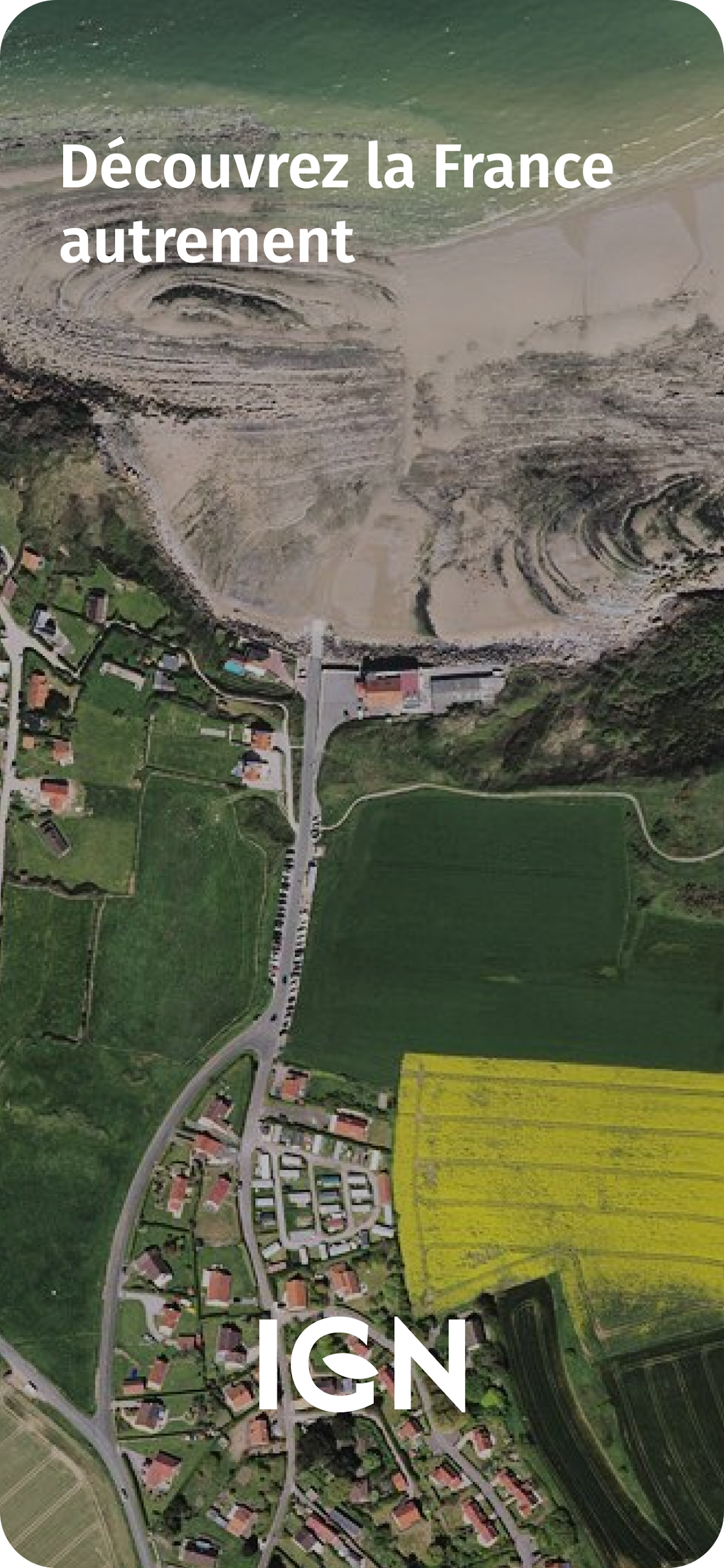
Embark on a journey through the stunning landscapes of France with IGN Maps, a cutting-edge mapping and navigation app that provides users with access to a wealth of geographic data. From topographic maps to thematic information on agriculture, tourism, and transportation, IGN Maps offers a comprehensive look at the French territory. Explore points of interest, create routes, and even compare historical aerial photographs to witness the impact of climate change. Whether you're a seasoned explorer or a casual traveler, IGN Maps is the perfect tool for discovering and understanding the diverse landscapes of France. Start your adventure today!
⭐ Detailed IGN Maps
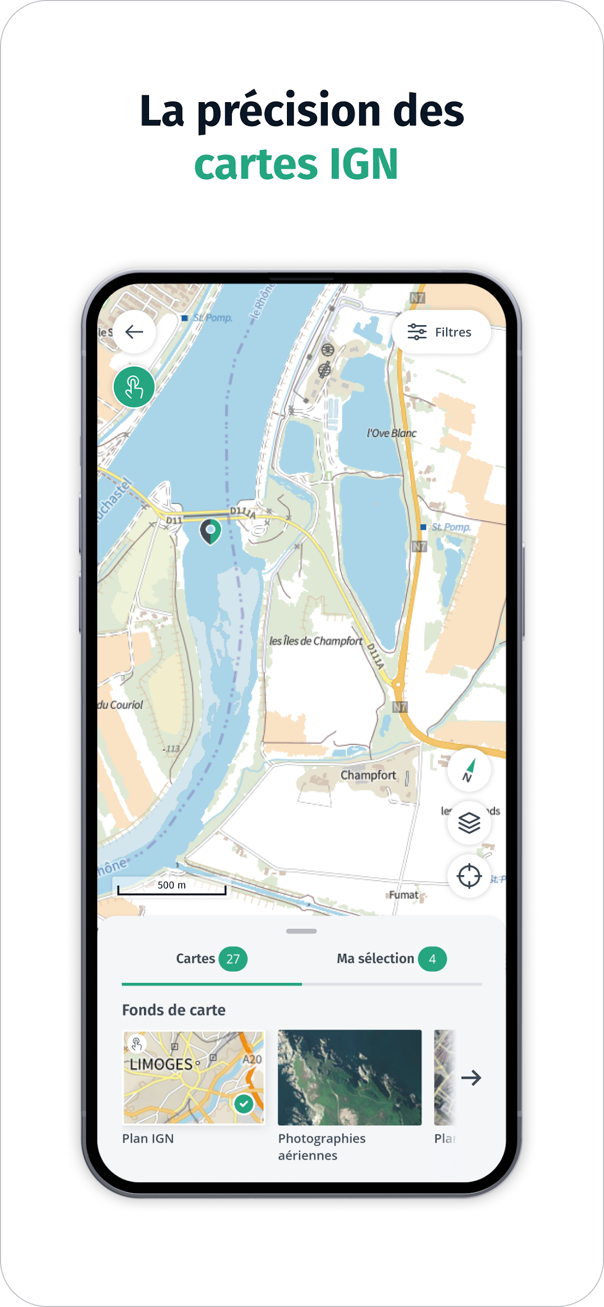
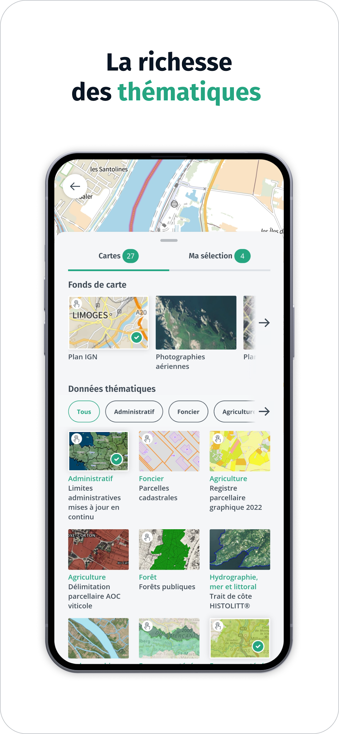
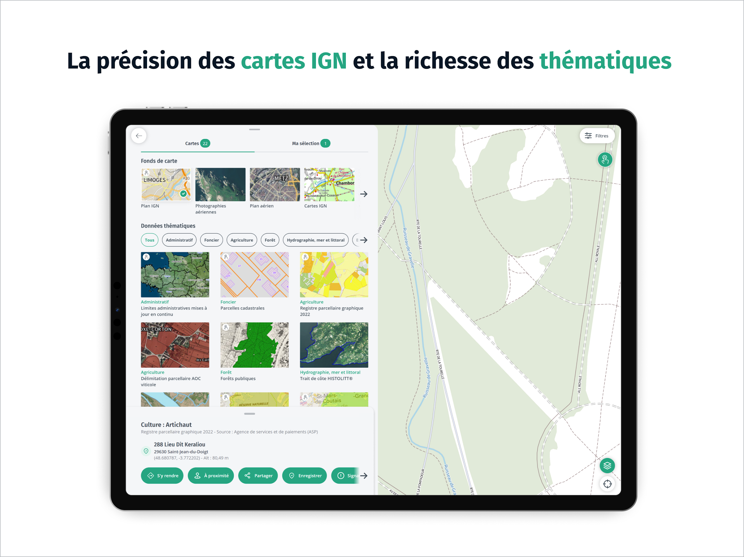
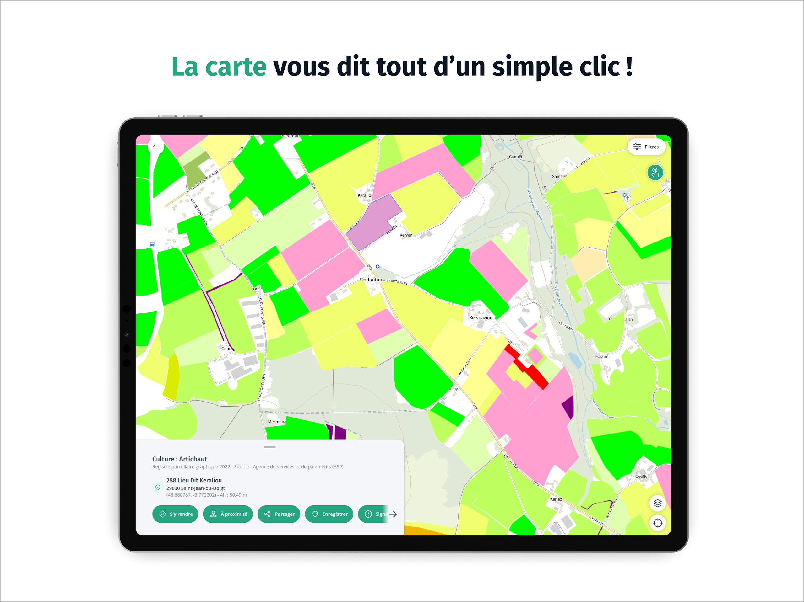
Explore the French territory with precision using IGN plan and topographic maps. Get a wealth of thematic geographic data provided by IGN and its partners, including administrative, land use, agriculture, forestry, tourism, protected areas, and transportation.
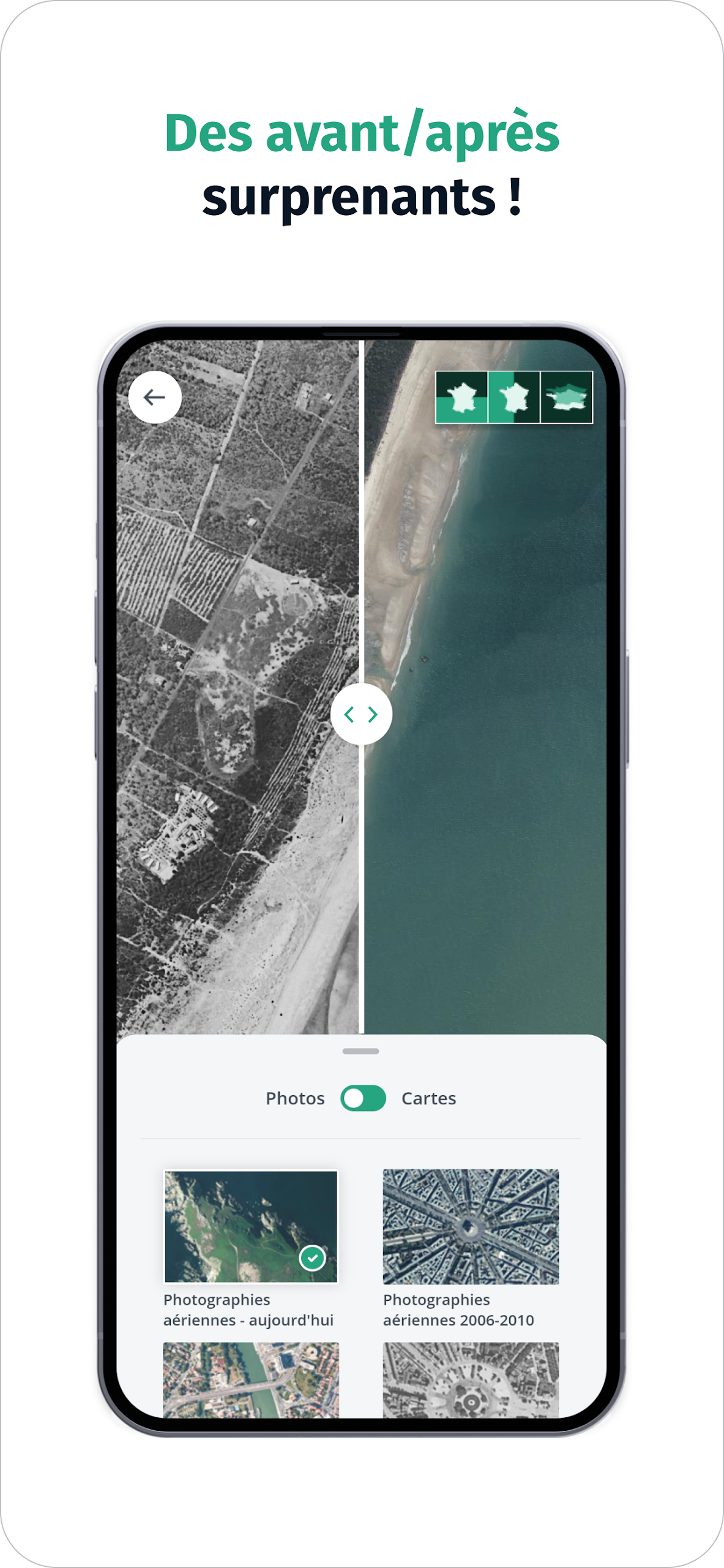
⭐ Evolution of French Landscapes
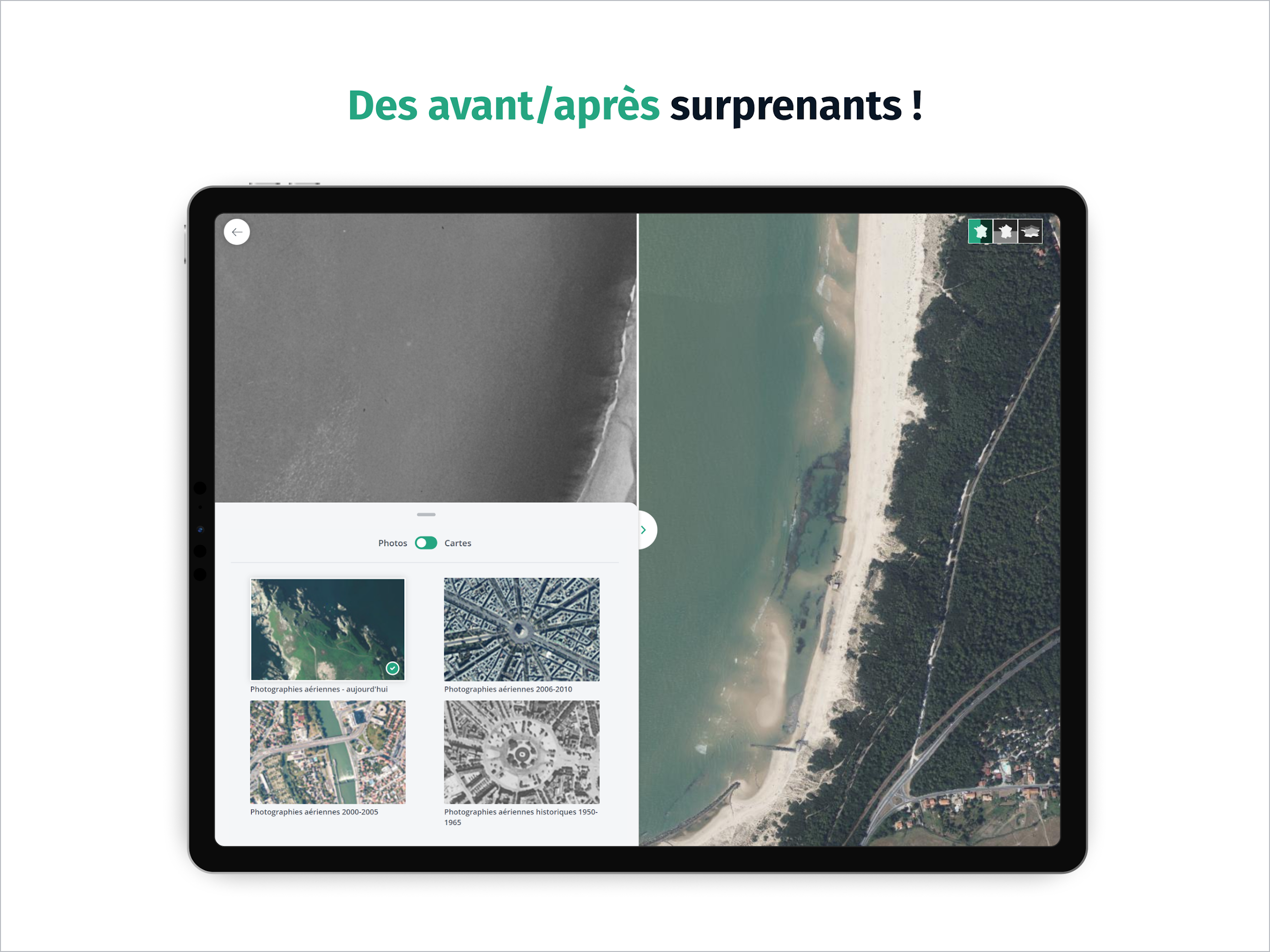
Fly over France and observe the evolution of French landscapes in the era of climate change. Compare IGN maps or aerial photographs from different epochs to see the human footprint on the territory.
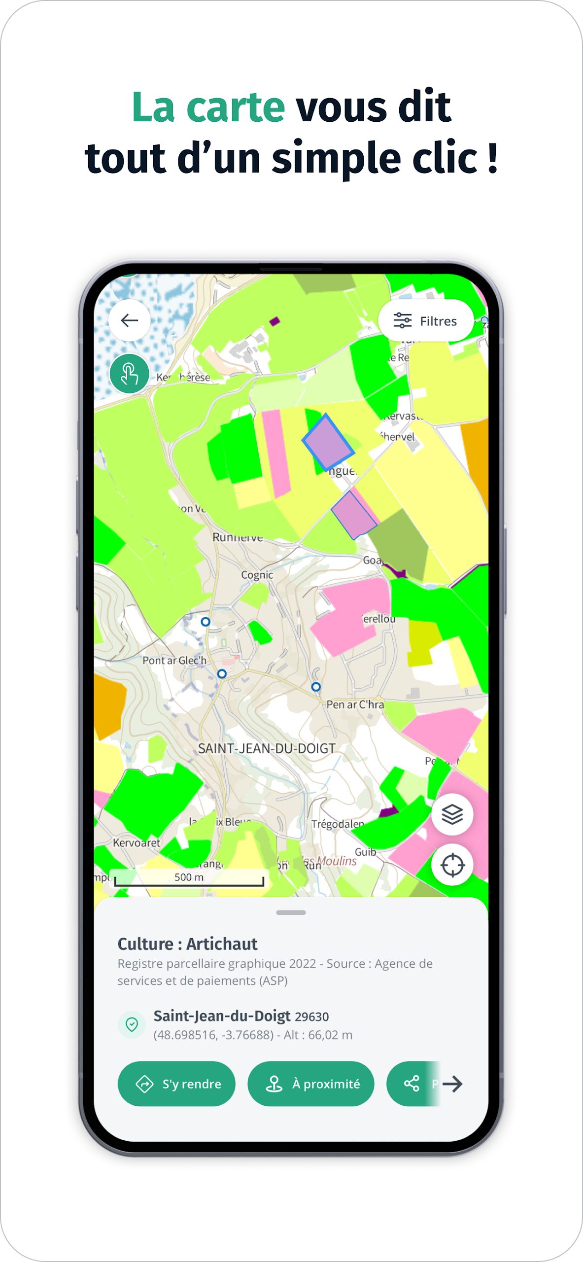
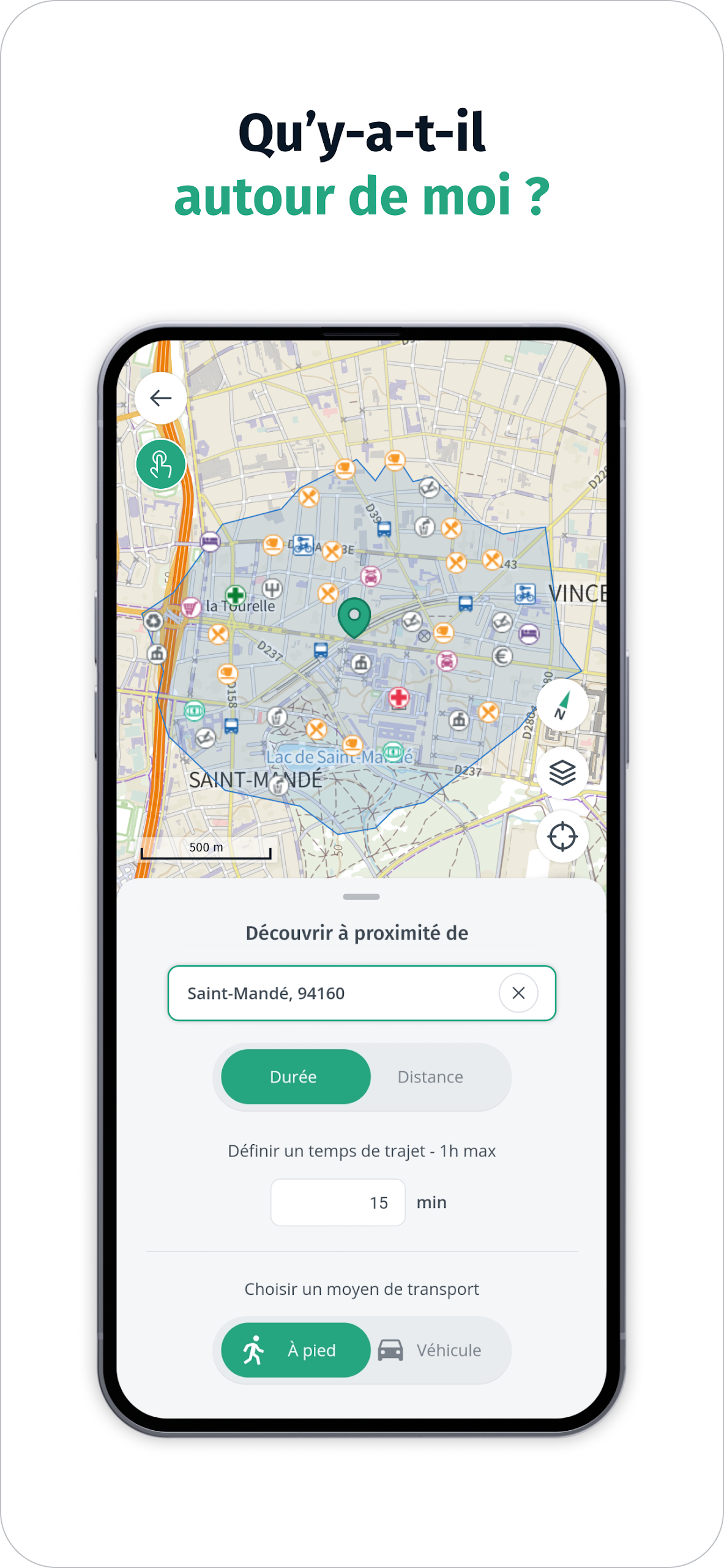
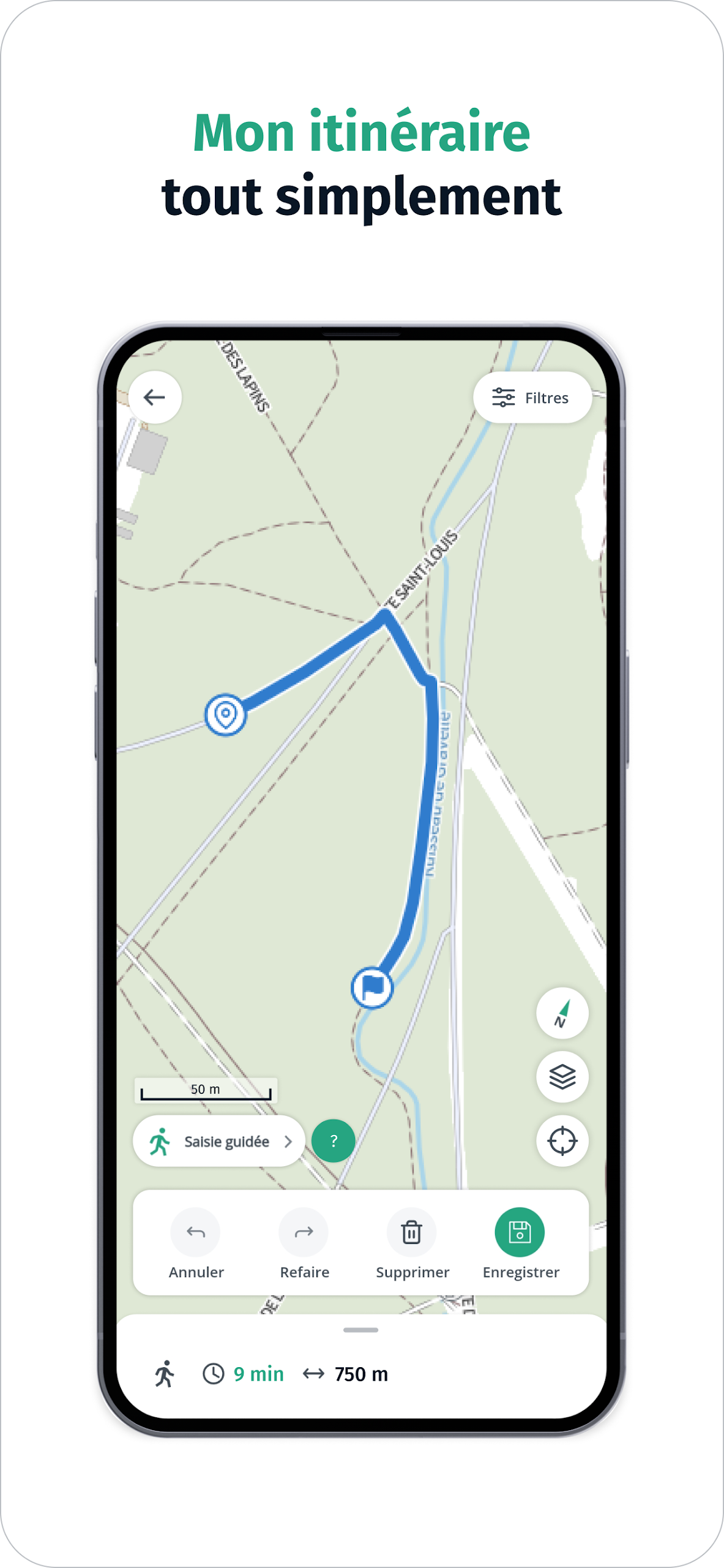
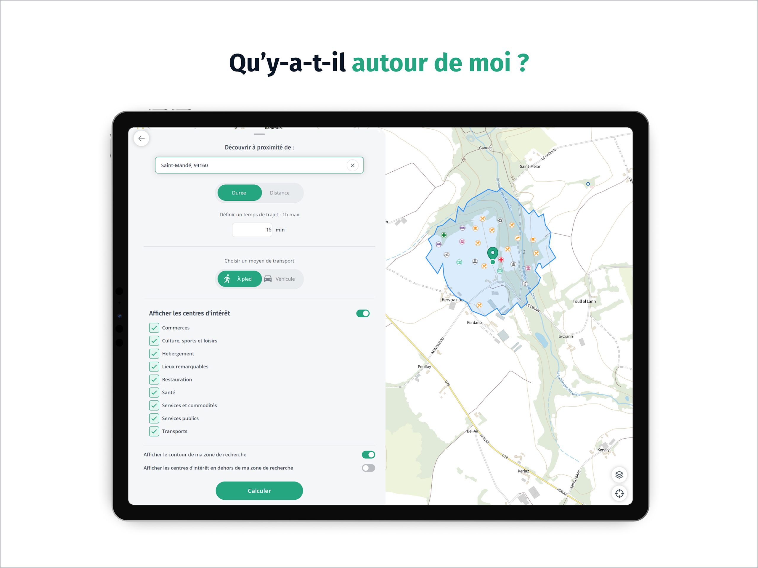
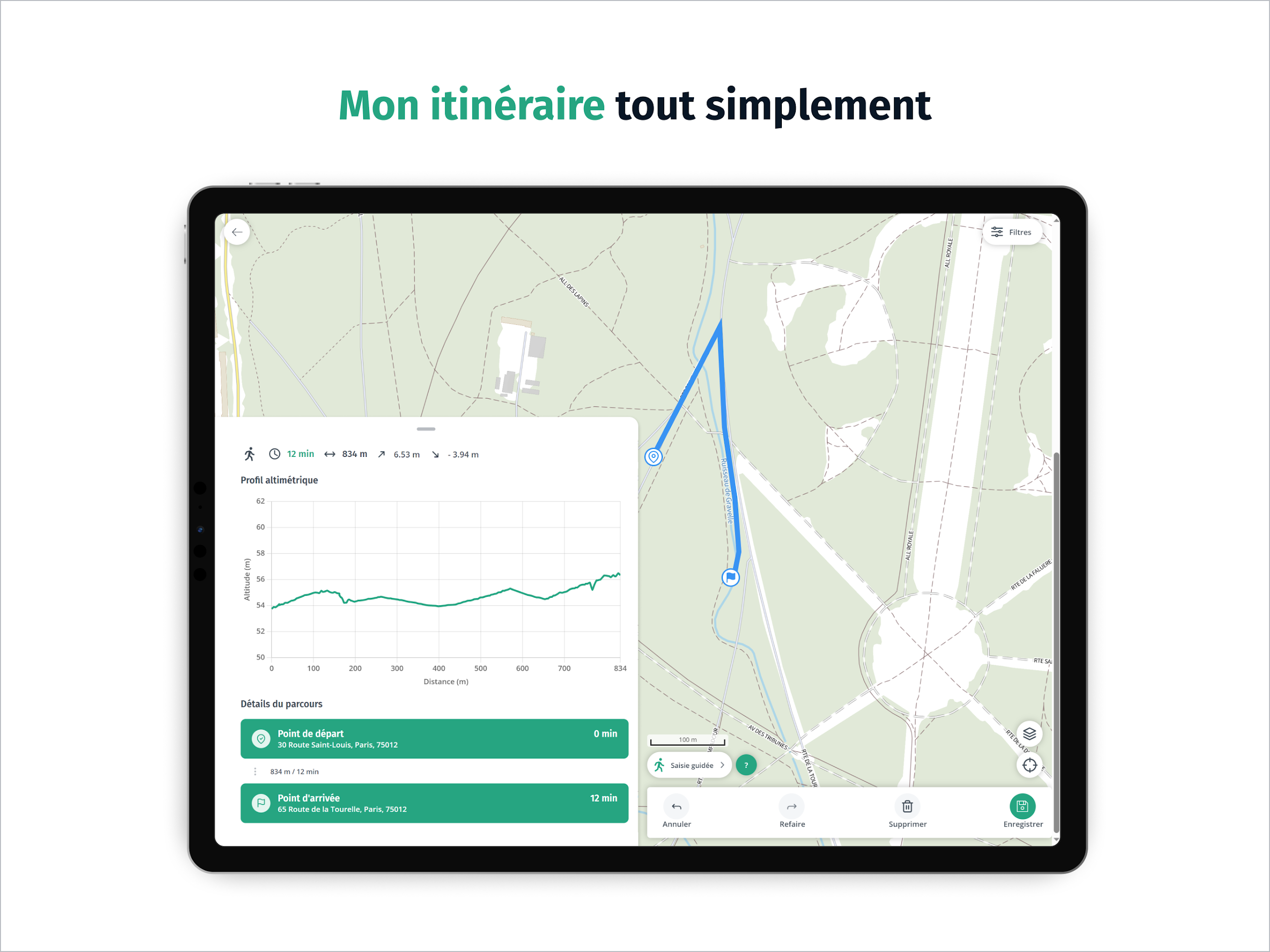
⭐ Points of Interest
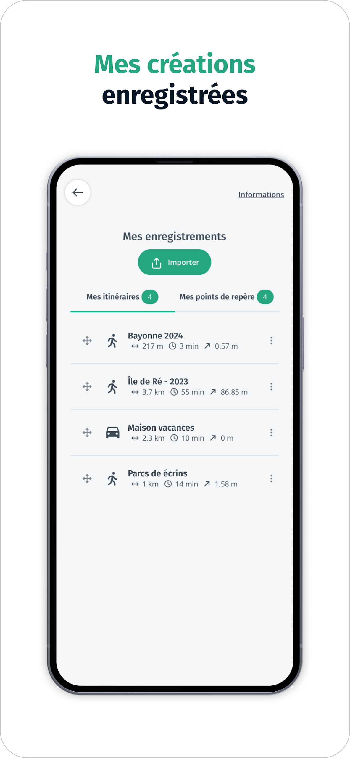
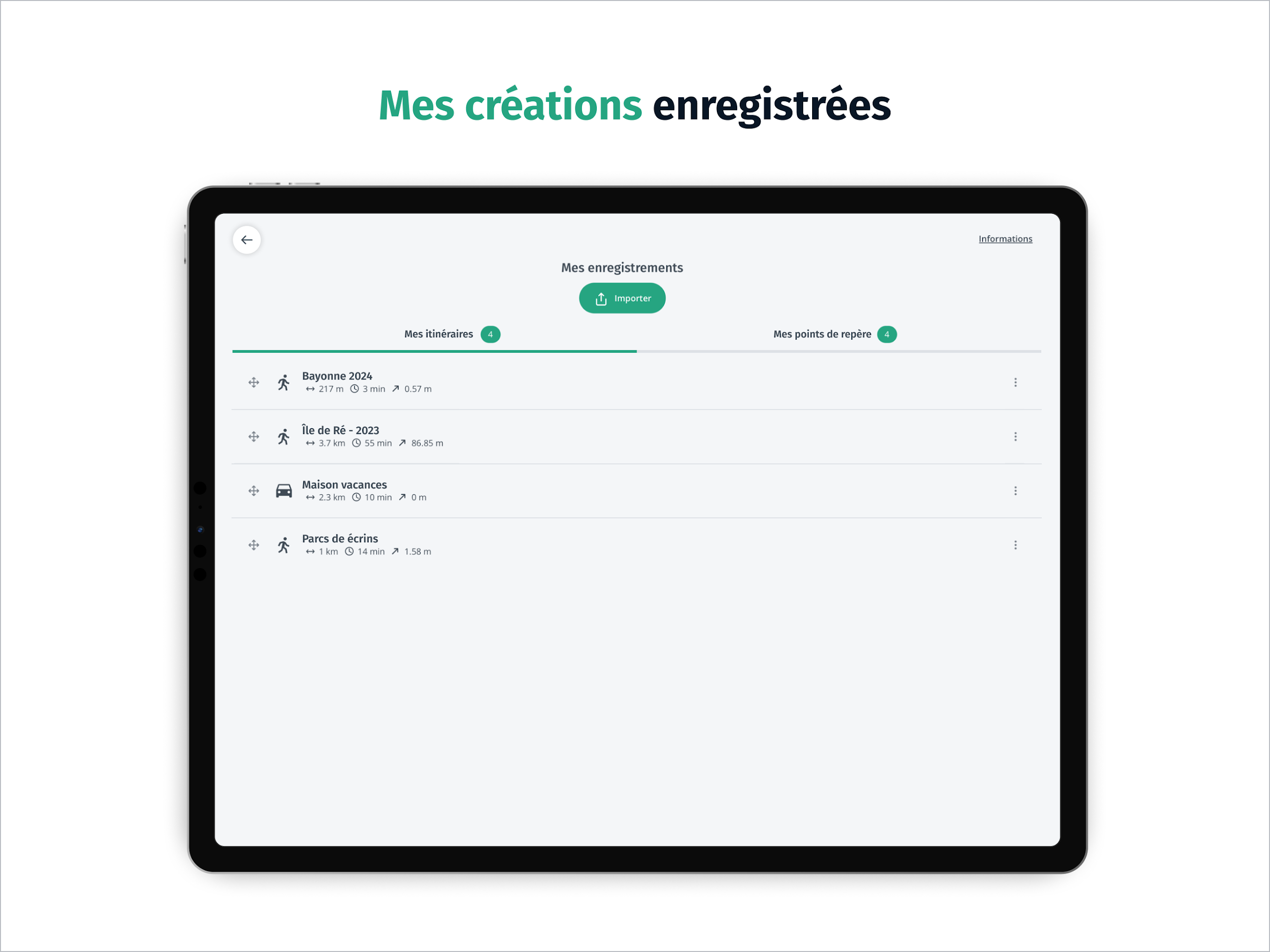
Discover points of interest around you with IGN Maps. Access practical tools for moving without being tracked, such as calculating a route, tracing a path, creating and saving a landmark, displaying your position, and sharing it with loved ones.
⭐ Display Problems
Experiencing display problems or data layers not showing on the Géoportail website or application? Update the Géoportail application to the latest Android version of your phone or browse with recommended browsers like Mozilla Firefox or Google Chrome.
⭐ Geoportal Not Displayed Correctly
If the Géoportail is not displaying correctly after an update, try clearing your browser's cache to ensure a correct display.
⭐ Browser Recommendation
For the best experience with the Géoportail, use a browser that is less than one year old such as Mozilla Firefox, Google Chrome, Microsoft Edge, or Safari.
Embark on a journey to explore the French territory with precision and detail using the Cartes IGN app. With access to IGN plan and topographic maps, thematic geographic data, and practical tools for navigation, IGN Maps offers a comprehensive mapping experience for users. Explore the evolution of French landscapes, discover points of interest, and enjoy a secure and informative exploration of the French territory with Cartes IGN.
File size: 12.60 M Latest Version: 3.3.18
Requirements: Android Language: English
Votes: 445 Package ID: fr.ign.geoportail
Developer: IGN-France

Best Free Travel Apps for Your Android Phone
Make travel planning effortless with our all-in-one trip companion app! Get insider tips from locals on top attractions, hidden gems, restaurants, and accommodations at your destination. Book flights, rental cars, and hotels at the lowest prices. Access maps offline; track bookings, itineraries, and reservations; create shared group trips; and auto-translate menus, signs, and conversations abroad. Our clever algorithms surface personalized recommendations everywhere you go.


LIVE A HERO
Retro Hero Mr Kim
Empire of Passion
Arcane Quest Legends
Magic Snap: Momotaro
AllStar Manga Heroes
Lunescape
ONE PIECE Thousand Storm JP
Tap Titans 2